C
E R R O D
E L A
M U E R T E

The best highland
birding in Costa Rica is found along the Interamericana between Cartago and San
Isidro. To bird the Mountain of Death
it is best to have a rental car but others could bus to their lodging on Cerro
de la Muerte and hike the nine kilometers to the paramo or take the inexpensive
tours offered by the hotel owners.
The
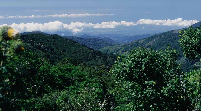
highway snakes up the continental divide with both Pacific and Caribbean slopes
on either side. With excellent acommodations, great roadside birding, and public
and private trails this is the place
to see Costa Rica's paramo and high-elevation avifauna. Other sites such as
Volcans Poas and Irazu can be eliminated from your itinerary as these sites will
not produce further species. Paramo at the summit (elevation 3,000-3,491 m) is
the most easily accessed in the country. The cool winds blow steadily at this
elevation; be sure to have a sweater ready even at noon!
This is possibly the most consistent site for Barred Parakeet in Central
America and large flocks may be encountered in early morning. The endemic
White-throated Mountain-gem is common at hummingbird feeders around the San
Gerardo de Dota lodges.
At
the sign for San Gerardo, one-hundred meters past the 80 Km post of the
Interamericana, a graded gravel road twists and turns steeply downhill into a
beautiful valley and to the community of San Gerardo de Dota. Here, the better
accommodations for birding the surrounding highlands are found. The admired
Resplendant Quetzal is found with comparitive ease amid the giant oaks and
avocado trees in some of the most splendid scenery in the country. The oaks at
Km 3 and the avocado trees at Km 5.2 along the road harbour quetzals. Elegant
Euphonia are found in treed gardens. The road may possibly be too steep for
underpowered vehicles. Be sure to use the lowest gear or reverse the car uphill.
The hotels charge US$10 for rides from Km 80.
42 CERRO DE LA MUERTE
TARGET BIRDS
Highland
Tinamou • Kms 58-95
Albergue Mirador de Quetzals at Km
Spotted Wood-Quail • Kms
58-95
70; turn and proceed 1 mile almost
Maroon-chested
Ground-Dove • Km 95
guaranteed to see birds; $6 fee.
Sulphur-winged
Parakeet • Kms 58-95
Barred
Parakeet • Kms 58-96.5
BIRDING SITES
Bare-shanked
Screech-Owl • Kms 58-95
Dusky
Nightjar • Kms 58-95
∆ Km 58 Canon Church & Genesis II
Fiery-throated
Hummingbird • 58-95
∆ Km 61 4 WD road to Rio Macho
White-throated
Mountain-gem • 80-95
Km 62 A. Montana de Tapanti; obtain
Scintillant Hummingbird
• Kms 58-80
key for gated road on left at Km 66
Volcano
Hummingbird • Kms 58-95
∆ Km 63 key at store for gate Km 65.8
Resplendent
Quetzal • Kms 58-96.7
∆ Km 65.8 road on right leads to cloud
Ruddy
Treerunner • Kms 58-95
forest with large oaks
Buffy
Tuftedcheek • Kms
58-96.7
∆
Km 66 road to stunted forest
Streak-breasted
Treehunter • Kms 58-95
∆ Km 70 Mirador de Quetzals
Silvery-fronted
Tapaculo • Kms 58-95
∆ Km 70.4 bamboo
Ochraceous
Pewee • Kms 58-96.7
∆ Km 77 bamboo at Restaurant
Black-capped
Flycatcher • Kms 58-95
Chespirito at village of Oja de Agua
Silvery-throated
Jay • Kms 58-96.7
∆ Km 80 bamboo
Ochraceous
Wren • Kms 58-95
∆ Km 80.1 road to San Gerardo hotels
Timberline
Wren • Kms 80-95
(bamboo)
∆ Km 86
powerline at edge of paramo
Mountain
Robin • Kms 58-95
∆ Km 88.5
paramo 3337 m; road on left
Sooty
Robin • Kms 80-95
∆ Km 89 El
Torres Restaurant
Black-faced
Solitaire • Kms 80-95
∆ Km 89.3
road 1 1/2 km-long road to
Ruddy-capped
Nightingale-Thrush • 58-80
towers on highest point
Black-billed
Nightingale-Thrush • 58-95
∆ Km 90
excellent site
Black-and-yellow
Silky-flycatcher • 58-95
∆ Km 95 La
Georgina Hotel
Long-tailed
Silky-flycatcher • Km
58-95
∆ Km 95.1 La
Georgina trail
Yellow-winged
Vireo • Kms 65.8-95
∆ Km 96.5
road to Villa Mills School
Flame-throated
Warbler • Kms 58-95
∆ Km 96.7 road red metal pole-gate
Collared
Redstart • Kms 58-95
∆ Km 97 road joins above down to oaks
Black-cheeked
Warbler • Kms 58-95
∆ Km 107 is small village of Division
Wrenthrush
• Kms 58-95 (bamboo)
(3.5 km west Avalon Reserva Privada)
Golden-browed
Chlorophonia • 80-95
Spangle-cheeked Tanager
• Kms 58-80
Sooty-capped
Bush-Tanager • Kms
58-95
ACCOMMODATIONS
Black-thighed
Grosbeak • Kms 58-80
Blue
Seedeater • Kms 66-95
(bamboo)
∆
***
Albergue de Montana Savegre
Slaty
Finch • Km 77
∆ ***
Trogon Lodge
Peg-billed
Finch • Kms 58-95
∆ **
Albergue de Montana Tapanti
Slaty
Flowerpiercer • Kms
58-95
∆
*
Cabinas El Quetzal
Large-footed
Finch • Kms 58-95
∆ *
Genesis II
Yellow-thighed
Finch • Kms 58-95
∆
La Georgina Hotel
Volcano
Junco • Kms 80-95
∆
Avalon Reserva Privada
Yellow-bellied
Siskin • Kms 77-95
MUERTE,
CHIRRIPO, LA ARMASTAD 43
Sites
along the Interamericana en route to
ROAD CONDITIONS
the
Cerro de la Muerte (below Km 58) such
as El
Empalme harbour few species not
The Interamericana is paved with
found
in the montane oak forests between
sporatic potholes from Cartago
Kms
61-80. These species can be found
through San Isidro. There are a few
with
less effort at other lower montane
washed out sections and slides
rainforest
sites such as Tapanti.
that cause one-lane traffic signed
derrumbes en la via. Do not
pass
in these areas.
∆ ∆
∆ Parque Nacional Chirripo
Chirripo
is one of Costa Rica's largest parks at 50,150 hectares. Most of the park is
above 2,000 meters and contains the countries highest peak. There are hiking
trails and three simple mountain huts (US$2.50 nightly; reservations required
but seldom full with up to 60 beds each). No camping allowed!
Driving from San Isidro, continue 1/2 km south on the Interamericana
crossing both the Rios San Isidro and Jilguero. Look for a steep turn up to the
left 300 meters beyond the Jilguero bridge with a sign Pollo Brasilia opposite.
A few hundred meters down the road there are further signs. The road is paved to
Rivas (halfway point), then steep and gravelled but passable to ordinary cars. A
ranger station is found after driving 21 km, one km below the small village of
San Gerardo de Rivas (elevation 1,350 meters). You can park your car safely at
the ranger station and walk the remaning distance. There is a restriction of 40
visitors a day into the reserve; tel. 257-2239 for information. Just above the
ranger station (pay US$6 fee; open 5 am to 5 pm daily) the road forks. Take the
right fork to San Gerardo de Rivas where you will find the simple Restaurant Roca Dura Cafe for meals. A well-marked but strenuous 15
kilometer, 10-hour trail leads up to the summit of Cerro Chirripo at 3,820
meters. Be aware of the possibility of altitude sickness and cautious of the
extreme temperature variables. Passing through pasturelands outside the park,
the trail ascends through tropical lower montane and then montane rainforest.
The evergreen oak forests harbour trees that reach 50 meters in height with
heavy epiphytic growth and thick bamboo and fern understories. At the summit is
wind-swept paramo. Obviously most birders will just explore the lower sectors,
the first few kilometers of trail, which are excellent for numerous bird species
including Resplendant Quetzal, Buffy Tuftedcheek and Flame-throated Warbler.
∆ ∆
∆ ∆ ∆
Parque Nacional La Armastad
Combined
with Chirripo and several biological reserves, this is the largest protected
area in Costa Rica, some 600,000-hectares. La Armistad itself has 193,929
hectares, half of which extends into Panama. Remote, this World Heritage Site
protects nine life zones with habitats from rainforest at 200 meters to paramo
at 3,549 meters. With such diversity there is an avifaunal list of about 500
species. As development is nonexistant, only those wishing an uncomfortable
night of camping will be interested. As with other parks entrance fee is US$6
and camping is US$2 with no one to collect. Park headquarters is at Progreso,
near the Zona Protectora Las Tablas. The only "developed" site is
reached from Progreso where a nine-km trail heads uphill into the Las Tablas
area where you can camp and watch birds. (See San Vito map).
GUANACASTE
45
G
U A
N A C
A S
T E

Vast plains of savannah,
rolling hills, towering volcanoes, extensive marshes, endless blue skies, and a
low population density. For those who love dry environments, this region will
soon become your favourite region of Costa Rica. Shady gallery forests along
quiet rivers are reminescent of Arizona's wooded canyons and the humidless, warm
morning air so much more comfortable than the damp forests of the highlands and
the humid lowland rainforests of the Caribbean and Southwest. However, the
blazing sun at high-noon drives man and beast into the generous shade created by
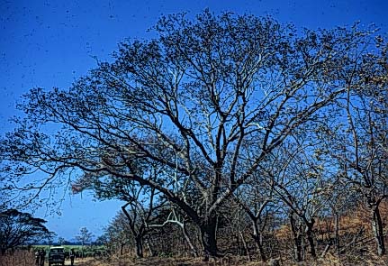
the unmistakable umbrella-shaped Guanacaste tree, a tree which often grows in
complete isolation on the rolling terrain. The aridity is accentuated by the hot
dry winds sweeping in from the Pacific. In the dry season, many rivers dry.